
Wales is set for a spell of wet and very windy weather today as Storm Chandra moves across the country, prompting the Met Office to issue a Yellow Weather Warning for large parts of Wales.
Storm Chandra is bringing widespread rain, heavy at times, across southern and mid Wales through Tuesday morning. Rainfall totals of 20 to 30mm are expected in many areas, with much higher totals of 50 to 80mm possible across higher ground, including the Bannau Brycheiniog.
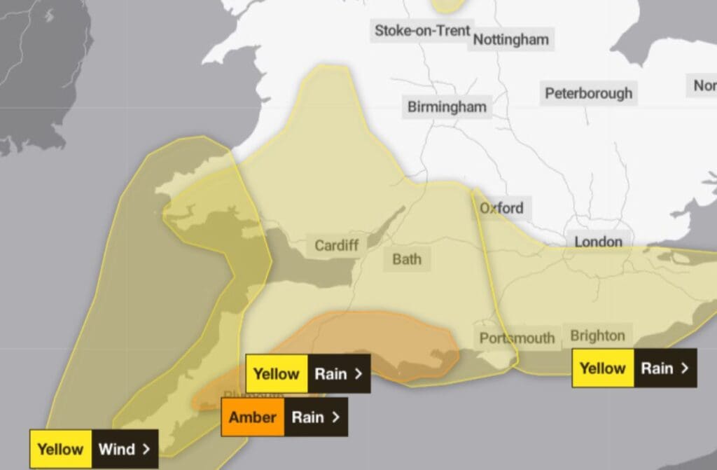
With ground already saturated following recent wet weather, the Met Office warns that further heavy rain could increase the risk of surface water flooding in some areas. Strong southeasterly winds are also expected, with gusty conditions particularly noticeable in exposed and coastal locations.
Today will start wet and windy, with spells of heavy rain and gales affecting exposed areas. During the morning, rain will gradually ease, with a brighter afternoon developing. However, conditions will remain blustery, with some heavy showers still possible. Temperatures will reach around 10°C.
Tonight, there will be some clear spells early in the evening, alongside blustery showers. Showers are expected to persist near the west coast overnight, while most other areas become dry. Winds will ease, allowing temperatures to fall, with a minimum of around 3°C.
Wednesday will see a mix of sunshine and scattered showers. Showers are most likely across southern and western parts of Wales, where they could be heavy at times. Southerly winds will remain brisk in the west, with temperatures reaching about 9°C.
Looking ahead to Thursday through to Saturday, the unsettled weather looks set to continue. Skies will often be cloudy, with periods of showery rain at times. Breezy conditions will persist initially as the week draws to a close and into the start of the weekend.
People are advised to stay up to date with the latest forecasts and warnings from the Met Office, especially if travelling or living in areas prone to flooding.