
An amber weather warning has been issued for heavy rain across large parts of Wales, with flooding possible today.
The Met Office says persistent and often heavy rain will affect much of south and southwest Wales during Monday. Rainfall totals of 50 to 80mm are expected widely, with some areas seeing close to 100mm. With ground already saturated following recent wet weather, the risk of flooding and disruption is higher.
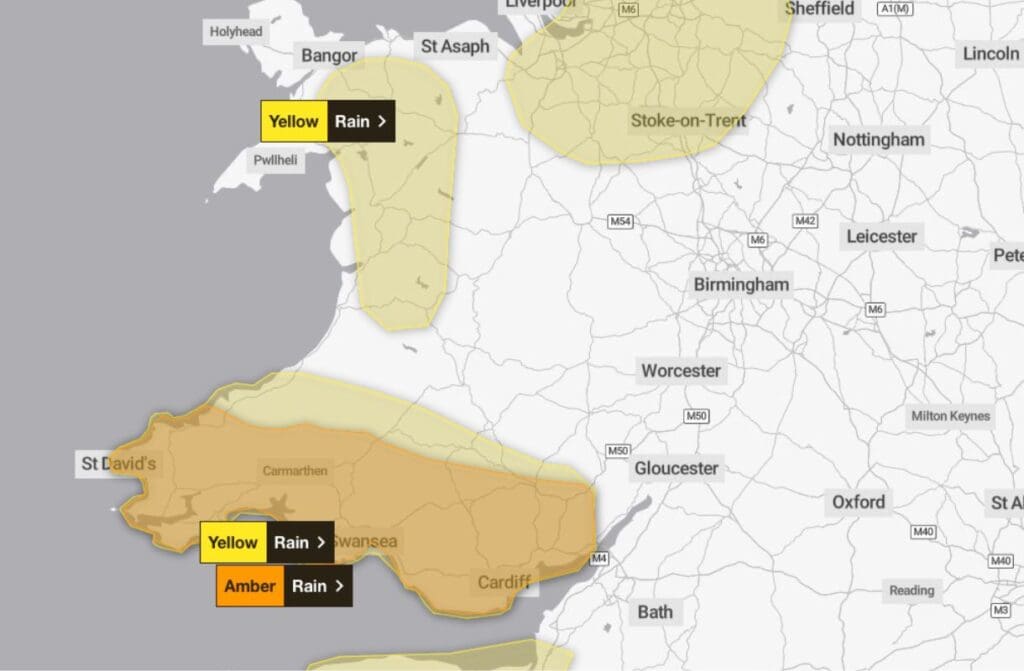
The warning covers many local authority areas including Cardiff, Swansea, Rhondda Cynon Taf, Neath Port Talbot, Carmarthenshire, Pembrokeshire, Powys, Monmouthshire, Newport and the Vale of Glamorgan, along with several other parts of Wales.
Today is expected to be very wet for many, with rain heavy and persistent at times. Flooding is likely in places, particularly in southern and western areas, where travel disruption is most likely. Winds will generally be light, and it will stay mild with temperatures reaching around 11°C.
This evening and overnight, conditions are expected to remain very wet for many areas, with further flooding and travel disruption possible. It should gradually become drier later in the night, but there is a chance of ground frost and fog developing as temperatures fall to around 2°C.
On Tuesday, any mist or fog should clear to leave a drier and brighter day for most, with some sunshine developing. It will feel cooler, though winds will remain light, with temperatures reaching about 10°C.
Looking ahead to the rest of the week, conditions are expected to turn windier on Wednesday with coastal gales possible. Further rain is likely at times, becoming heavy and persistent again by Thursday. Friday should be brighter and breezier, with sunny spells and isolated showers, and milder conditions.
People are urged to take care, plan journeys in advance and stay up to date with the latest forecasts and warnings.