
Wales will see a brighter and drier day than of late, with the Met Office forecasting some welcome sunny spells this afternoon, although unsettled conditions are set to return quickly.
After a murky start with low cloud and hill fog in many areas, conditions are expected to lift through the morning. Forecasters say the day should gradually brighten, with the best of any sunshine developing later, though the odd shower remains possible. It will become breezy along coastal areas during the afternoon, with temperatures reaching a maximum of 10°C.
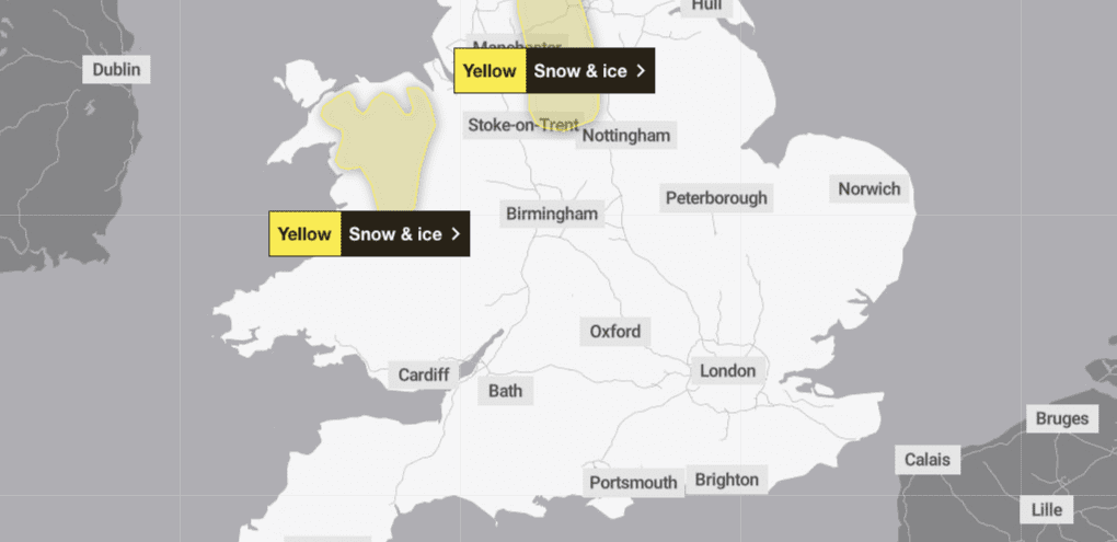
A yellow weather warning for snow and ice remains in place this morning for parts of Mid and North Wales. The warning covers Conwy, Denbighshire, Flintshire, Gwynedd, Powys and Wrexham, where some icy stretches and lingering wintry hazards are still possible.
Tonight will see conditions change once again. Cloud is expected to build from the east through the evening, with patchy drizzle likely over higher ground. Overnight, a band of rain will push northwards bringing heavy downpours and strengthening winds. The Met Office says coastal gales are possible, with temperatures falling no lower than 5°C.
Thursday is set to begin dull and damp, with widespread cloud and outbreaks of rain across the country during the morning. Heavy showers are expected to follow, with further spells of rain later in the day. Winds will remain strong at first before easing as the day progresses, with a maximum temperature of 9°C.
Looking ahead to the end of the week, the unsettled theme continues. Forecasters predict further outbreaks of heavy showers and periods of prolonged rain from Friday through to Sunday, although there may be some brief brighter intervals over the weekend. It will stay breezy at times.
Residents are advised to keep an eye on local updates, particularly in areas still affected by the snow and ice warning.