Following overnight rain and showers, more intense showers and thunderstorms are expected to break out fairly widely from late-morning on Thursday, before easing during the evening.
Whilst most areas will miss the most intense storms, torrential downpours are possible in a few places. Where these occur, there is potential for 20 to 30 mm of rain in less than an hour and up to 40 mm in 2 hours. This would have the potential to generate surface water flooding, especially if it falls over an urban area.
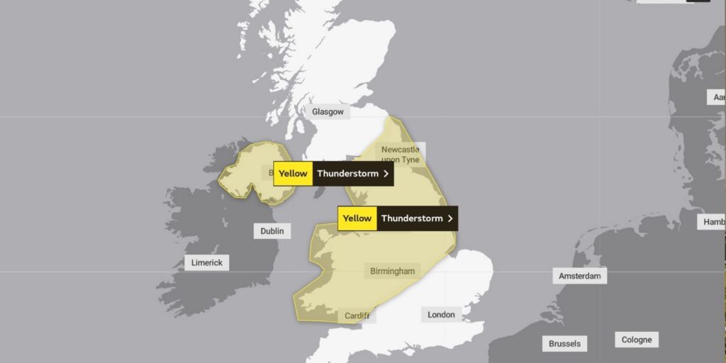
What to expect
- There is a small chance that homes and businesses could be flooded quickly, with damage to some buildings from floodwater, lightning strikes, hail or strong winds
- Where flooding or lightning strikes occur, there is a chance of delays and some cancellations to train and bus services
- Spray and sudden flooding could lead to difficult driving conditions and some road closures
- There is a small chance that some rural communities could temporarily become cut off by flooded roads
Local authorities affected
- Blaenau Gwent
- Bridgend
- Caerphilly
- Cardiff
- Carmarthenshire
- Ceredigion
- Conwy
- Denbighshire
- Flintshire
- Gwynedd
- Isle of Anglesey
- Merthyr Tydfil
- Monmouthshire
- Neath Port Talbot
- Newport
- Pembrokeshire
- Powys
- Rhondda Cynon Taf
- Swansea
- Torfaen
- Vale of Glamorgan
- Wrexham